
BRIEF HISTORY AND INTRODUCTION
Jhang District is a district of the Punjab province of Pakistan. The city of Jhang is the district’s capital. According to the 1998 census of Pakistan, the district’s population was 2.8 million, of which 23 percent lived in urban areas. By 2008, according to estimates, the population had risen to 3.5 million. The native language is Punjabi, though Urdu is also spoken in educational institutions.
Jhang is one of the oldest districts on the subcontinent(being one of five districts established in Punjab in 1849), having being populated even around 2,000 BC, when it was known as Jhagi Sial. Jhang is bordered by Sargodha District to the north, Gujranwala District to the northeast, Faisalabad District and Toba Tek Singh District to the east, Khanewal and Muzaffargarh District to the south, Leiah District and Bhakkar District to the west, and Khushab District to the northwest.
The district comprises on four administrative units (tehsils) Jhang, Athara Hazari, Shorkot, and Ahmad Pur Sial.
Jhang District covers 8,809 km². Almost all the area is cultivatable land except in the north near Rabwah and Chenab Nagar where the land turns rocky as it approaches the Kirana hills. The western portion of the district holds the Thal Desert, which starts in Mari Shah Sakhira and extends to banks of the Jhelum River far to the west in the districts of Khushab and Bhakkar. There is also an area known as the Sandal Bar arising from Pabbarwala near the Gujranwala boundary. “Bar”, in the local language, means a forested area where there are no resources for cultivation, like water. This area used to be forested and was unable to be cultivated before British colonial rule, when a canal system was installed near the town of Lyallpur (now Faisalabad), which is now the textile industry hub of Pakistan. Between the rivers Jhelum and Chenab is also a small area of Kirana bar, ending at Ghoriwala village. The area alongside the banks of rivers Ravi, Chenab and Jhelum is called Hitthar (area in which flood water reaches), while the upland area between the bars and Hitthar is called Utar.
History
Jhang District was agricultural region with forests during the Indus Valley Civilization. The Vedic period is characterized by Indo-Aryan culture that invaded from Central Asia and settled in Punjab region. The Kambojas, Daradas, Kaikayas, Madras, Pauravas, Yaudheyas, Malavas, Saindhavas and Kurus invaded, settled and ruled ancient Punjab region. After overunning the Achaemenid Empire in 331 BCE, Alexander marched into present-day Punjab region with an army of 50,000. The Okara was ruled by Maurya Empire, Indo-Greek kingdom, Kushan Empire, Gupta Empire, White Huns, Kushano-Hephthalites and Shahi kingdoms.
In 997 CE, Sultan Mahmud Ghaznavi, took over the Ghaznavid dynasty empire established by his father, Sultan Sebuktegin, In 1005 he conquered the Shahis in Kabul in 1005, and followed it by the conquests of Punjab region. The Delhi Sultanate and later Mughal Empire ruled the region. The Punjab region became predominantly Muslim due to missionary Sufi saints whose dargahs dot the landscape of Punjab region. After the decline of the Mughal Empire, the Sikh invaded and occupied Jhang District. The Muslims faced severe restrictions during the Sikh rule. During the period of British rule, Jhang district increased in population and importance.
The predominantly Muslim population supported Muslim League and Pakistan Movement. After the independence of Pakistan in 1947, the minority Hindus and Sikhs migrated to India while the Muslim refugees from India settled in the Jhang District.
Culture and religion
Punjabi folk dances such as Jhummar and Sammi originated in Jhang District. Jhummar is a dance for men while Sammi is for women. The district also originated a well-known form of folk music known as “Dhola”, or “Jhang da Dhola”.
Traditionally men wear turbans and dhotis (similar to a skirt or kilt) though in recent years people have started wearing the national dress, the shalwar kameez. Some older women also wear dhotis. When women wear dhotis, the style is referred to called “Majhla” in Jhangochi; th male style is called “Dhudder”. However, it is more common for women to wear shalwar kameez.
The northwestern Jhang District, particularly the area at the west bank of the Jhelum River, is somewhat different in its culture because it is more influenced by the Thalochi culture emanating from the neighboring districts of Mianwali and Bhakkar .
Jhang District has dominant Muslim population(both Shia and Sunni.The non-Muslim minorities include small number of Ahmadiyya and Christ.
Source: Wikipedia / GoB officials

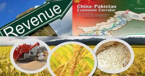
AGRICULTURE PROFILE
DETAILS OF PRIMARY CROPS AND LIVESTOCK
MAIN CROPS (2008-09) | |||||
| Wheat | Rice | Fruits | Vegetables | Fodder |
In Tonnes | 1122900 | 182000 | 75446 | 95672 | 3386100 |
Area (He) | 401000 | 102800 | 8448 | 7220 | 140900 |
Tonne / He | 2.79 | 1.77 | 8.93 | 13.25 | 24.03 |
MAIN LIVESTOCK (2006) thousand number | ||||
| Cattle | Sheep/Goat | Buffalo | Camel |
Number of Heads | 873 | 1392 | 1175 | 3.084 |
LAND AREA AND LAND USE
LAND USE | AREA (Ha) | % of Total Distt Area |
Total Geographical Area | 1472 | 100 |
Area Reported | 616 | 41.84 |
Area Under Forest | 5 | .003 |
Not Available for Cultivation | 55 | 3.73 |
Culturable Waste | 75 | 5.09 |
Current Fallow (C.F) | 37 | 2.51 |
Net Sown (N.S) | 444 | 30.16 |
Area Sown more than once (A.S.M.T.O) | 240 | 16.30 |
Net Cultivated Area (C.F + N.S) | 481 | – |
Net Cropped Area (N.S + A.S.M.T.O) | 684 | – |
Source: Irrigation Department
2.1 CLIMATE
(In MM/ºC)
AVERAGE RAINFALL & TEMPERATURES | |||||||||||||
MONTHS | |||||||||||||
| J | F | M | A | M | J | J | A | S | O | N | D | Aver. |
Mean Rainfall | 18 | 35 | 24 | 13 | 18 | 48 | 82 | 87 | 43 | 9 | 11 | 12 | 33.33 |
Max. Temp. | 19 | 22 | 27 | 33 | 39 | 39 | 35 | 35 | 34 | 30 | 27 | 21 | 30.08 |
Min. Temp. | 8 | 11 | 16 | 20 | 26 | 28 | 27 | 27 | 25 | 20 | 14 | 9 | 19.25 |
Source: http://www.myweather2.com/City-Town/Pakistan/Jhang/climate-profile.aspx?month=1
2.2 AGRICULTURE STATISTICS
Crop | Area (Ha) | Production (Tonnes) | Yield T/Ha | |||
| 2007-08 | 2008-09 | 2007-08 | 2008-09 | 2007-08 | 2008-09 |
Wheat | 371900 | 401000 | 963800 | 1122900 | 2.59 | 2.80 |
Rice | – | 102800 | – | 182000 | – | 1.77 |
Fodder | 141500 | 140900 | 3398100 | 3386100 | 24.02 | 24.03 |
Fruits | 8662 | 8448 | 77059 | 75446 | 9.12 | 8.93 |
Vegetables | 8093 | 7220 | 115874 | 95672 | 14.32 | 13.25 |
MAJOR GRAINS, FRUITS &VEGETABLES
S.NO | CATEGORY | NAMES |
A. | GRAINS | Wheat, Rice, Maize. |
1 | Oil seeds | Rape Seed, Mustard. |
2. | Pulses | Moong, Mash, Masoor. |
3. | Fodder | Lucern, Jowar, Bajra. |
B. | FRUITS | Mango, Citrus, Guava, Water Melon, Musk Melon Jaman, phalsa. |
C. | VEGETABLES | Tomato, Onion, Lady Finder, Tinda, Radish, Cabbage, Cauliflower, Carrot, Bitter & Bottle Gourd, Potato, Pumpkin, Cauliflower, Brinjal, |
D. | OTHER | Chillies, Coriander, Garlic |
Source: Agriculture Statistics
2.2.1 VEGETABLES
Vegetable | Area (Hectare) | Production (Tonnes) | ||
07-08 | 08-09 | 07-08 | 08-09 | |
Chilli | 155 | 160 | 236 | 259 |
Coriander | 59.0 | 61.0 | 38.0 | 42.0 |
Garlic | 122.0 | 127.0 | 929.0 | 996.0 |
Ginger | 0.0 | 0.0 | 0.0 | 0.0 |
Onion | 1299.0 | 1310.0 | 8412.0 | 11063.0 |
Sugar beet | 0.0 | 0.0 | 0.0 | 0.0 |
Tomato | 115.0 | 111.0 | 1410.0 | 1375.0 |
Potato | 6343.0 | 5451.0 | 104849.0 | 81937.0 |
Source: Agriculture Statistics
2.2.2 FRUITS
Fruits | Area (Hectare) | Production (Tonnes) | ||
07-08 | 08-09 | 07-08 | 08-09 | |
Apple | 0.0 | 0.0 | 0.0 | 0.0 |
Apricot | 0.0 | 0.0 | 0.0 | 0.0 |
Banana | 26 | 26 | 160 | 165 |
Citrus | 4741 | 4484 | 37617 | 35730 |
Dates | 803 | 840.0 | 5776.0 | 5924.0 |
Grapes | 0.0 | 0.0 | 0.0 | 0.0 |
Guava | 1337.0 | 1340.0 | 13459.0 | 13542.0 |
Mango | 1751.0 | 1754.0 | 20026.0 | 20063.0 |
Plums | 0.0 | 0.0 | 0.0 | 0.0 |
Pomegranate | 4 | 4 | 21 | 22 |
Peach | 0.0 | 0.0 | 0.0 | 0.0 |
Pear | 0.0 | 0.0 | 0.0 | 0.0 |
Source: Agriculture Statistics
2.3 IRRIGATIONS SCHEMS AND THEIR OUTPUTS
Irrigation Scheme | Irrigated Area (Ha) | Non Irrigated Area | Total area sown |
09-10 | 09-10 | 680 | |
Canal | 29 | ||
Wells | 12 |
| |
Tube Wells | 171 |
| |
Canal wells | 24 |
| |
Canal tube wells | 370 |
| |
Total | 606 | 74 |
Source: Irrigation Department
2.4 LIVESTOCK
Livestock | 2006 Census |
Mules | 1084 |
Horses | 12755 |
Donkeys | 113474 |
Camels | 3084 |
Bullocks | 48130 |
Male buffaloes | 33 |
Female Buffaloes | 495 |
Cows | 552 |
Total | 179607 |
Source: Department of Agriculture & Livestock
2.5 ANIMAL SLAUGHTERED
Livestock | 2009-10 |
Cattle / Cows | 148 |
Sheep | 260 |
Goat | 554 |
Others | 1 |
Buffalos | 161 |
Total | 1124 |
Source: Department of Agriculture & Livestock
2.6 VETERINARY INSTITUTION
Veterinary Institution | 2009-10 |
Hospitals | 17 |
Dispensaries | 71 |
A.I. Centre | 3 |
A.I. Centre stands for Artificial Insemination Centre
D.I.L. Unit Stands for Disease Investigation Laboratory Units


AOA Sir aap ny District Jhung main Sugarcane Crop ka Zikkar hee nahe kiya