Gujrat (Urdu: ضِلع گُجرات), is adistrict of Punjab Province in Pakistan. It is an ancient district located in between two famous rivers, the Jhelum and Chenab. Because of its proximity with the rivers the land is good for cultivation with rice and sugar cane as main crops. It is bounded on the northeast by Mirpur, on the northwest by the River Jhelum which separates it from Jhelum District, on the east and southeast by the Chenab River, separating it from the districts of Gujranwala and Sialkot, and on the West by Mandi Bahauddin. District Gujrat is spread over an area of 3,192 square kilometres, and is divided into three tehsils, Gujrat, Kharian, and Sarai Alamgir. There are many historic villages and towns in the district such as Chakdina, Karnana, Kunjah and Lalamusa.
The Punjab region became predominantly Muslim due to missionary Sufi saints whose dargahs dot the landscape of Punjab region. Authentic history commences only in the Lodi period, when Bahlolpur, 23 miles (37 km) north-east of Gujrat, was founded in the reign of Bahlol (1451–89). Khwas Khan, governor of the Rohtas under Sher Shah Suri, founded Khwaspur near Gujrat. The settlement of the tract was completed by Akbar, who built a fort and compelled the Gujars to settle in it. The tract was then named Gujrat and formed into a separate district. Revenue records have been preserved in the families of the hereditary registrars (kanungos), and these exhibit Gujrat the capital of a district containing 2,592 villages, paying revenue of 11.6 million. In 1605 the famous Saiyid Abdul Kasim received Gujrat as a tuyul or fief from Akbar. On the decay of the Mughal power, Nadir Shah occupied the Gujrat district. The country also suffered at the same time from invasion of Ahmad Shah Durrani, whose armies frequently crossed and recrossed it. After the decline of the Mughal Empire, the Sikh invaded and occupied Gujrat. The Muslims faced severe restrictions during the Sikh rule.
After the decline of the Mughal Empire, the Sikh invaded and occupied Gujrat District. The Muslims faced severe restrictions during the Sikh rule. In 1765 Sardar Gujar Singh Bhangi, one of the head of the Bhangi Sikh confederacy, crossed the river Chenab, defeated the Muslim Gakhar chief, Mukarrab Khan,Sardar Gujar Singh Brought Gujrat District under Sikh rule for 81 years.
In 1846 Gujrat came under the supervision of British officials, when a settlement of land revenue was effected under order from the provisional government at Lahore. Two years later, the District was the scene of some of the battles which decided the event of the second Sikh War. While the siege of Multan still dragged slowly on, Sher Singh established himself at Ramnagar on the Gujrawala side of the Chenab, 22 miles (35 km) below Gujrat, leaving the main body of his army on the northern bank. Here he awaited the attack of the British, who attempted unsuccessfully to drive him across the river, on November 22, 1848. Lord Gough withdrew from the assault with heavy loss; but sending round a strong detachment under Sir Joseph Thackwell by the Wazirabad ferry; he turned the flank of the enemy, and won the battle of Sadullapur. Sher Singh retired northward, and took up a strong position between the Jhelum and the Pabb Hills. The bloody battle of Chilianwala followed (January 13, 1849) a victory as costly as a defeat. On February 6 Sher Singh again eluded Lord Gough’s vigilance, and marched southwards to make a dash upon Lahore; but the British pressed him close in the rear and, on February 22, he turned to offer battle at Gujrat. The decisive engagement which ensued broke irretrievably the power of the Sikh. The Punjab lay at the feet of the conquerors, and passed by annexation under British rule.
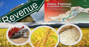
The predominantly Muslim population supported Muslim League and Pakistan Movement. After the independence of Pakistan in 1947, the minority Hindus and Sikhs migrated to India while the Muslim refugees from India settled in the Gujrat district. Most of the refugees have since settled and inter-married into the local population. Ever since, Sialkot has become one of the major industrial centers of Pakistan and is well known for its manufacture and export of surgical instruments, musical instruments, sports goods, leather goods, textile products and other light manufactures.. Since independence Gujrat has became one of the major industrial and commercial centers of Pakistan. There are over 5,000 cottage-level and small- to large-scale industrial units operating in the district. Rice production and export is another major product of Gujrat. There are many other factories engaged in manufacturing of electrical goods, electric motors and rice cleaning mills. Most are cottage industries, providing employment to a large number of people and accounting, in aggregate, for more than 90 percent of the domestic market.
Source: Wikipedia / GoB officials


AGRICULTURE PROFILE
2 DETAILS OF PRIMARY CROPS AND LIVESTOCK
MAIN CROPS (2008-09) | |||||
| Wheat | Rice | Fruits | Vegetables | Fodder |
In Tonnes | 294 | 109.3 | 2427.0 | 2932.0 | 436.4 |
Area (He) | 158.2 | 59.1 | 441.0 | 287.0 | 15.2 |
Tonne / He | 1.85 | 1.84 | 5.50 | 10.21 | 28.71 |
MAIN LIVESTOCK 2006 census (000 numbers) | ||||
| Cattle | Sheep/Goat | Buffalo | Camel |
Number of Heads | 145 | 36/208 | 414 | 0.217 |
3 LAND AREA AND LAND USE
LAND USE | AREA ( 000 Ha) | % of Total Distt Area |
Total Geographical Area | 985 | 100 |
Area Reported | 321 | 32.58 |
Total Cultivated Area | 253 | 25.68 |
Area Under Forest | 12 | 1.21 |
Not Available for Cultivation | 46 | 4.67 |
Culturable Waste | 10 | 1.01 |
Current Fallow (C.F) | 22 | 2.23 |
Net Sown (N.S) | 231 | 23.45 |
Area Sown more than once (A.S.M.T.O) | 90 | 9.13 |
Net Cultivated Area (C.F + N.S) | 253 | – |
Net Cropped Area (N.S + A.S.M.T.O) | 321 | – |
Source: Irrigation Department
2.1 CLIMATE
(In MM/ºC)
AVERAGE RAINFALL & TEMPERATURES | |||||||||||||
MONTHS | |||||||||||||
| J | F | M | A | M | J | J | A | S | O | N | D | Aver. |
Mean Rainfall | 15 | 21 | 30 | 13 | 17 | 18 | 82 | 87 | 43 | 9 | 0 | 9 | 32.09 |
Max. Temp. | 19 | 21 | 27 | 33 | 39 | 39 | 35 | 35 | 34 | 30 | 25 | 21 | 29.83 |
Min. Temp. | 7 | 11 | 16 | 20 | 25 | 28 | 27 | 27 | 25 | 20 | 14 | 8 | 19.0 |
Source: http://www.myweather2.com/City-Town/Pakistan/Gujrat/climate-profile.aspx?month=1
2.2 AGRICULTURE STATISTICS
Crop | Area(Ha) | Production (Tonnes) | Yield T/Ha | |||
| 2007-08 | 2008-09 | 2007-08 | 2008-09 | 2007-08 | 2008-09 |
Wheat | 144100 | 158200 | 233600 | 294000 | 1.621 | 1.858 |
Rice | 44100 | 59100 | 82300 | 109300 | 1.866 | 1.849 |
Fodder | 15100 | 15200 | 377000 | 436400 | 24.966 | 28.710 |
Fruits | 576.0 | 441.0 | 3968.0 | 2427.0 | 6.88 | 5.50 |
Vegetables | 168.0 | 287.0 | 1575.0 | 2932.0 | 9.37 | 10.21 |
MAJOR GRAINS, FRUITS & VEGETABLES
S.NO | CATEGORY | NAMES |
A. | GRAINS | Wheat, Rice, Maize. |
1 | Oil seeds | Rape Seed, Mustard, Sunflower. |
2. | Pulses | Moong, Mash, Moth. |
3. | Fodder | Lucern, Jowar, Bajra, Maize. |
B. | FRUITS | Mango, Citrus, Guava, Water Melon, Musk Melon. |
C. | VEGETABLES | Tomato, Onion, Lady Finder, Tinda, Radish, Cabbage, Cauliflower, Carrot, Potato, Pumpkin, Cauliflower, Brinjal, |
D. | OTHER | Chillies, Coriander, Garlic |
Source: Agriculture Statistics
2.2.1 VEGETABLES
Vegetable | Area (Hectare) | Production (Tonnes) | ||
07-08 | 08-09 | 07-08 | 08-09 | |
Chilli | 2.0 | 2.0 | 3.0 | 3.0 |
Coriander | 0.0 | 3.0 | 0.0 | 1.0 |
Garlic | 26.0 | 26.0 | 122.0 | 146.0 |
Ginger | 0 | 0 | 0 | 0 |
Onion | 40.0 | 40.0 | 395.0 | 407.0 |
Sugar beet | 0 | 0 | 0 | 0 |
Tomato | 20.0 | 20.0 | 215.0 | 212.0 |
Potato | 80.0 | 196.0 | 840.0 | 2163.0 |
Source: Agriculture Statistics
2.2.2 FRUITS
Fruits | Area (Hectare) | Production (Tonnes) | ||
07-08 | 08-09 | 07-08 | 08-09 | |
Apple | 0 | 0 | 0 | 0 |
Apricot | 0 | 0 | 0 | 0 |
Banana | 5 | 5 | 20 | 20 |
Citrus | 43 | 43 | 193 | 160 |
Dates | 0 | 0 | 0 | 0 |
Grapes | 0 | 0 | 0 | 0 |
Guava | 514 | 380 | 3654 | 2149 |
Mango | 14 | 14 | 101 | 98 |
Plums | 0 | 0 | 0 | 0 |
Pomegranate | 0 | 0 | 0 | 0 |
Peach | 0 | 0 | 0 | 0 |
Pear | 0 | 0 | 0 | 0 |
Source: Agriculture Statisti
2.3 IRRIGATIONS SCHEMS AND THEIR OUTPUTS (thousand ha)
Irrigation Scheme | Irrigated Area (000 Ha) | Non Irrigated Area(000 Ha) | Total area sown(000 Ha) |
09-10 | 09-10 | 285 | |
Canal | 31 | 125 | |
Wells | 4 |
| |
Tube Wells | 97 |
| |
Canal wells | 2 |
| |
Canal tube wells | 26 |
| |
Total | 160 | 125 |
Source: Irrigation Department
2.4 LIVESTOCK (nos)
Livestock | 2006 Census |
Mules | 2562 |
Horses | 5853 |
Donkeys | 38534 |
Camels | 217 |
Bullocks | 2933 |
Male buffalos | 2 |
Female buffalos | 200 |
Cows | 258 |
Total | 50559 |
Source: Department of Agriculture & Livestock
2.5 ANIMAL SLAUGHTERED (00 numbers)
Livestock | 2009-10 |
Cattle / Cows | 1023 |
Sheep | 1559 |
Goat | 1786 |
Others | 2 |
Buffalows | 1103 |
Total | 5473 |
Source: Department of Agriculture & Livestock
2.6 VETERINARY INSTITUTION
Veterinary Institution | 2009-10 |
Hospitals | 13 |
Dispensaries | 35 |
A.I. Centre | 5 |
A.I. Centre stands for Artificial Insemination Centre
D.I.L. Unit Stands for Disease Investigation Laboratory Units


